-
- Required plugin "Meks Easy Photo Feed Widget" is required. Please install the plugin here. or read more detailed instruction about How to setup the plugin here
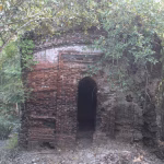
The dam of monkeys
Bandarban (Bengali: বান্দরবান, lit. “The dam of monkeys”), is a district in South-Eastern Bangladesh, and a part of the Chittagong Division. It is one of the three hill districts of Bangladesh and a part of the Chittagong Hill Tracts, the others being Rangamati District and Khagrachhari District. Bandarban city is the headquarters of the Bandarban district. Bandarban district (4,479 km2) is not only the most remote district of the country but also the least populous (population 292,900). There is an army contingent at Bandarban Cantonment.
Bandarban town is the hometown of the Bohmong Chief (currently King, or Raja, U Cho Prue Marma) who is the head of the Bohmong Circle. Of the other hill districts, Rangamati is the Chakma Circle, headed by Raja Devasish Roy and Khagrachari is the Mong Circle, headed by Raja Sachingprue Marma. Bandarban is regarded as one of the most attractive travel destinations in Bangladesh. It also is the administrative headquarters of Bandarban district, which has turned into one of the most exotic tourist attractions in Bangladesh.
The three highest peaks of Bangladesh – Tahjindong (1280 meters, also known as Bijoy), Mowdok Mual (1052 meters), and Keokradong (883 metres) – are located in Bandarban district, as well as Raikhiang Lake, the highest lake in Bangladesh. Heights measured with Garmin GPSMAP60CSX GPS are Tahjindong (1280 meters), Mowdok Mual (1052 m), and Keokradong (1230 m). Chimbuk Peak and Boga Lake are two more highly noted features of the district. The Sangu River (also known as Sangpo or Shankha), the only river born inside Bangladesh territory, runs through Bandarban. The other rivers in the district are Matamuhuri and Bakkhali. Parts of Kaptai Lake, the biggest lake in Bangladesh, fall under the district.
The newly reported highest peak of Bangladesh, Saka Haphong (3488 ft), is also here in Thanchi upazila. Most Bangladesh sources cite Keokradong as the highest peak in the country, but Tazing Dong (sometimes spelled as Tahjingdong, and also known as Bijoy) lying further east is recognised both by government and expert sources as a taller peak. Measurements taken by English adventurer Ginge Fullen shows that an officially unnamed peak near the Myanmar border (locally known as Mowdok Mual) is the highest point in Bangladesh. Recently a team from Nature Adventure Club took part in an expedition in the Mowdok range and agreed with Fullen’s statement. They put the height of this peak as 3488 feet with GPS accuracy of 3-metres. The unnamed summit is known as “Saka Haphong” to the local Tripura tribes.
The following is a list of mountain ranges in the area and the tallest peaks of each range:
| Range | Peak |
|---|---|
| Muranja (also known as Meranja) range | Basitaung, 664m |
| Wayla range (most of this range is in Myanmar) | |
| Chimbook range | Tindu, 898m |
| Batimain range | Batitaung, 526m |
| Politai range | Keokradang, 884m; Ramiu Taung 921m |
| Saichal-Mowdok range | Bilaisari, 669m; Mowdok Mual 1,003m |
| Saichal range | Waibung 808m; Rang Tlang, 958m; Mowdok Tlang, 905m |
| Wailatong and Tambang ranges |
Member Of:
+8801707700111, +8801580109735
[email protected]
[email protected]
Khulna Branch: 62, Khan Jahan Ali Road, Khulna
Gazipur Branch: K 286, BIDC Road,
Joydebpur, Gazipur
Sat - Thu 8.00 - 17.00 Friday CLOSED